
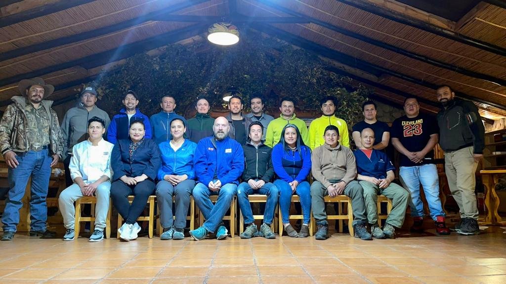
The Fortuna Project
Over US$2 billion invested in the construction of GOLD mines in Ecuador in just two years
Fortuna is a 550 km2 (54,985 hectares) property in the heart of a proven and highly mineralized mining district in Ecuador. It is strategically located within 80 km of numerous large gold-silver deposits containing over 40 M oz of gold, including:

over US$400 million raised by explorers with projects in Ecuador since Jan-2020
Prior to Lucky’s involvement, the Fortuna Project has seen only limited exploration and has never been drill tested, this is now about to change.
The property consists of 12, 100%-owned, contiguous mining concessions, which have been granted for a period of 25 years. The concessions is within a Miocene volcanic belt, known as the "Shincata Gold Trend”. The Shincata Gold Trend extends for approximately 22 kilometres from El Garo in the northeast to El Mozo epithermal gold deposit to the southwest, which lies just outside the Fortuna Concessions.
For detailed information on the Fortuna Project please review Technical reports filed on SEDAR.
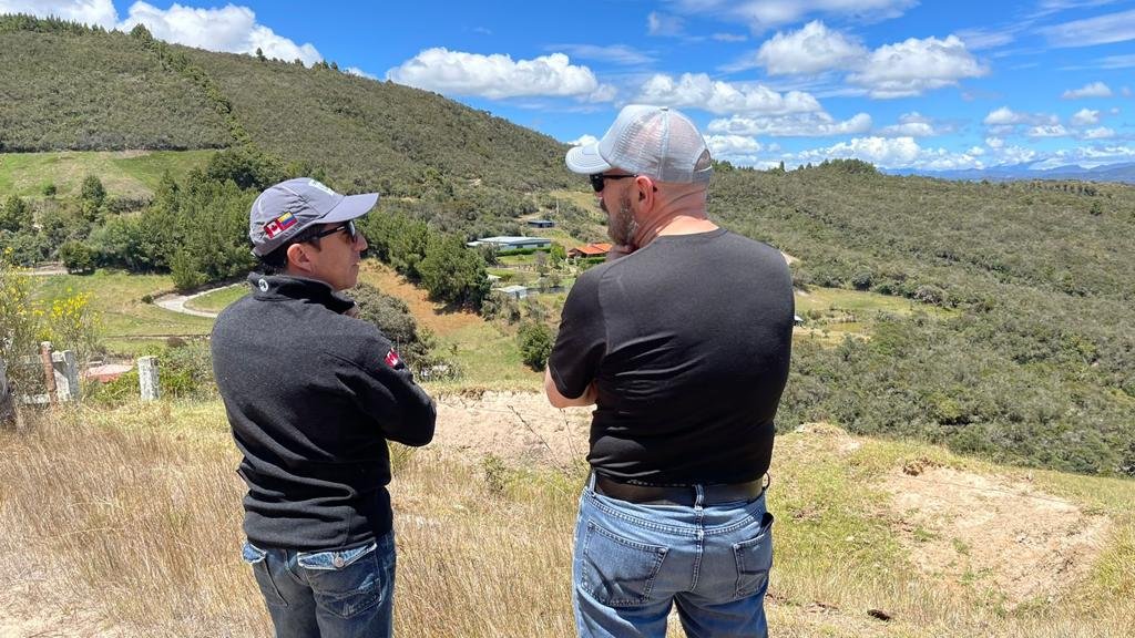
Lucky is preparing to drill test its recent Wayka epithermal gold discovery, while conducting reconnaissance exploration at Macuche and El Garo
Wayka
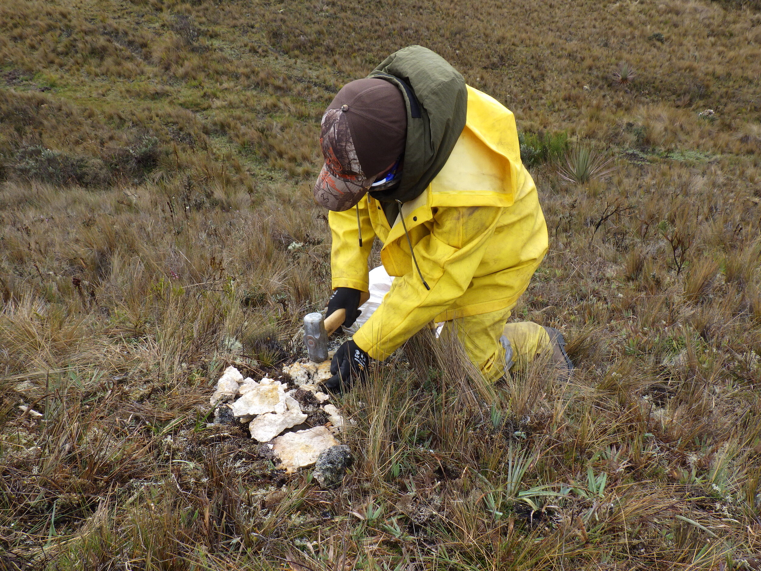
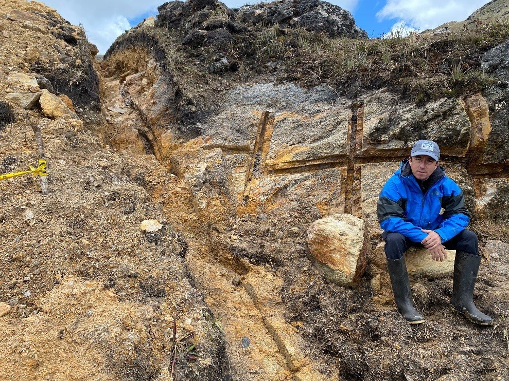
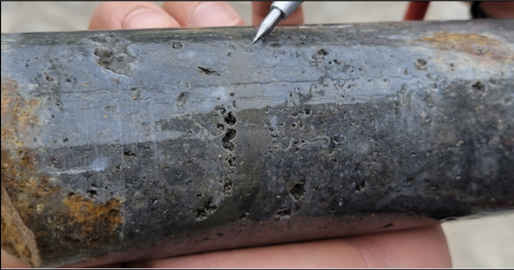
At the Wayka Epithermal Gold Discovery, trenches have shown large intercepts with high-grade gold mineralization at surface.
Macuche
At the Macuche Gold Target, sampling has demonstrated the presence of a significant gold-bearing system with grades up to 2.19g/t Au.
El Garo
The El Garo Gold Target contains a large area of advanced argillic alteration measuring approximately 2 km by 1 km that remains open in all directions.


550km2 of land
With a large land package in the country, Lucky has a strategic footprint.
full ownership
Lucky has 100% ownership of this substantive land package.
close to majors
The Fortuna Project is surrounded by large, producing mining companies.

MULTIPLE PROSPECTS
Current exploration is focused on 3 prospects on just a small portion of the concessions.

2,018km explored on foot
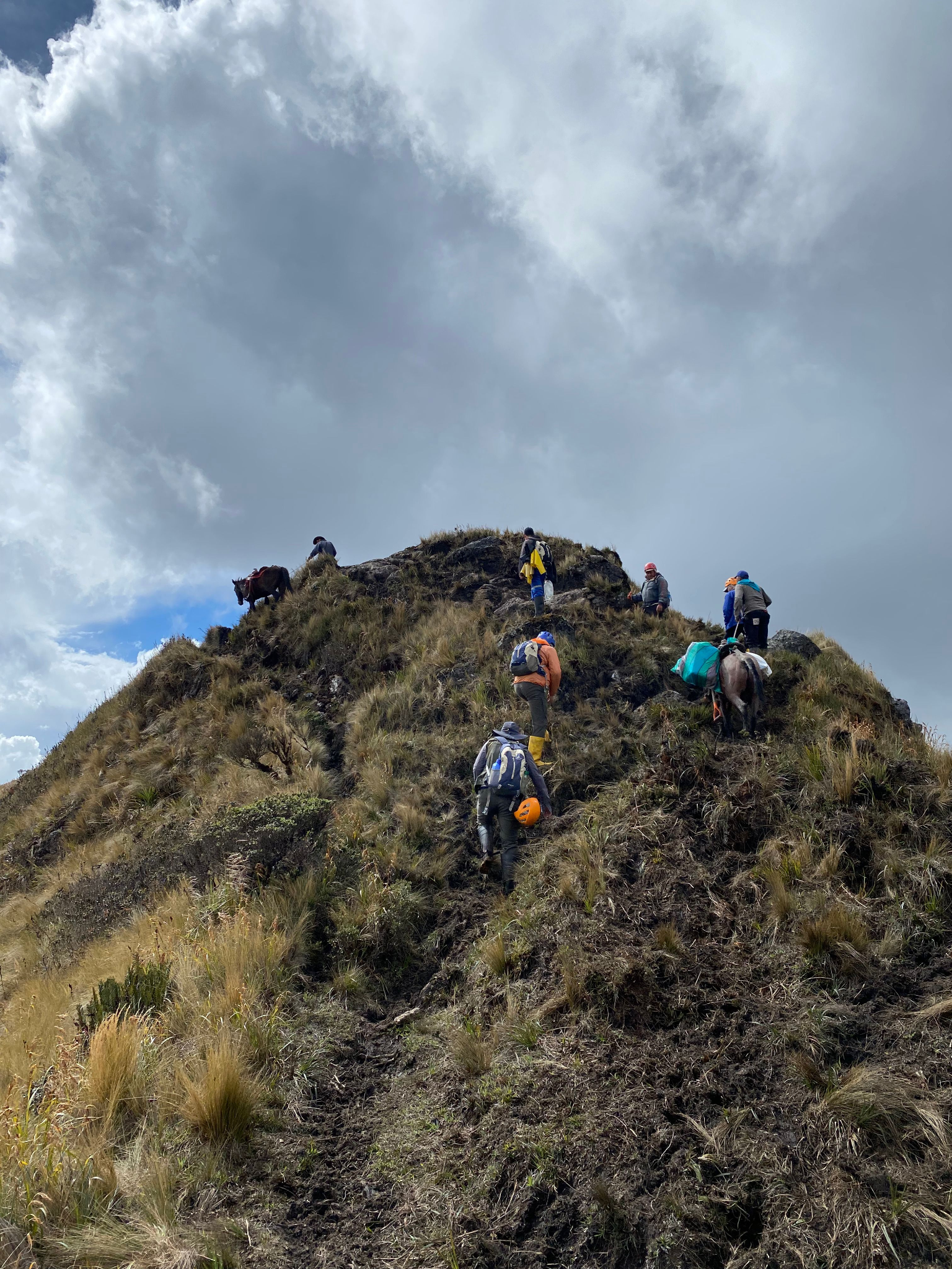
Our recently completed exploration program covered 2,018km of ground on foot.

Current & Historic operations
The area is host to current and more than 300 years of historic placer gold mining operations.
Recent News About Fortuna


Wayka
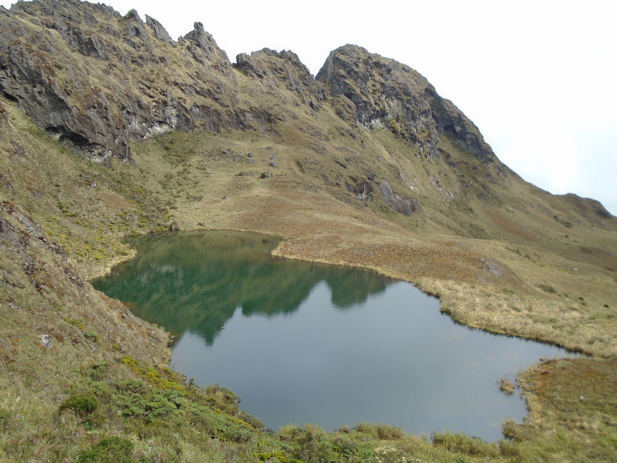
The Wayka Epithermal Gold Discovery is located within the central portion of the Fortuna concessions. It lies along an elevated ridge that trends north northeast with elevations ranging from approximately 3,600 meters to 3,700 meters above sea level.
Wayka is located within a large northeast trending 3,200 meter by 1,800 meter area of argillic, advanced argillic and silicic alteration, with outcrops of vuggy silica and quartz flooding that remain open in all directions. Advanced argillic alteration is a key higher-temperature alteration zone, with vuggy silica and silicification being a defining feature in the exploration for high-sulphidation epithermal gold mineralization.
“Epithermal gold-silver deposits range in size from tens of thousands to greater than 1 billion metric tons of ore and have gold contents of 0.1 to greater than 30 grams per metric ton and silver contents of less than 1 to several thousand grams per metric ton. Historically, these deposits have been an important source of gold and silver and are estimated to contain about 8 percent of global gold. The wide range of tonnage-grade characteristics makes epithermal gold-silver deposits an attractive target for small and large exploration and mining companies.” USGS Scientific Investigations Report 2010-5070-Q https://pubs.er.usgs.gov/publication/sir20105070Q
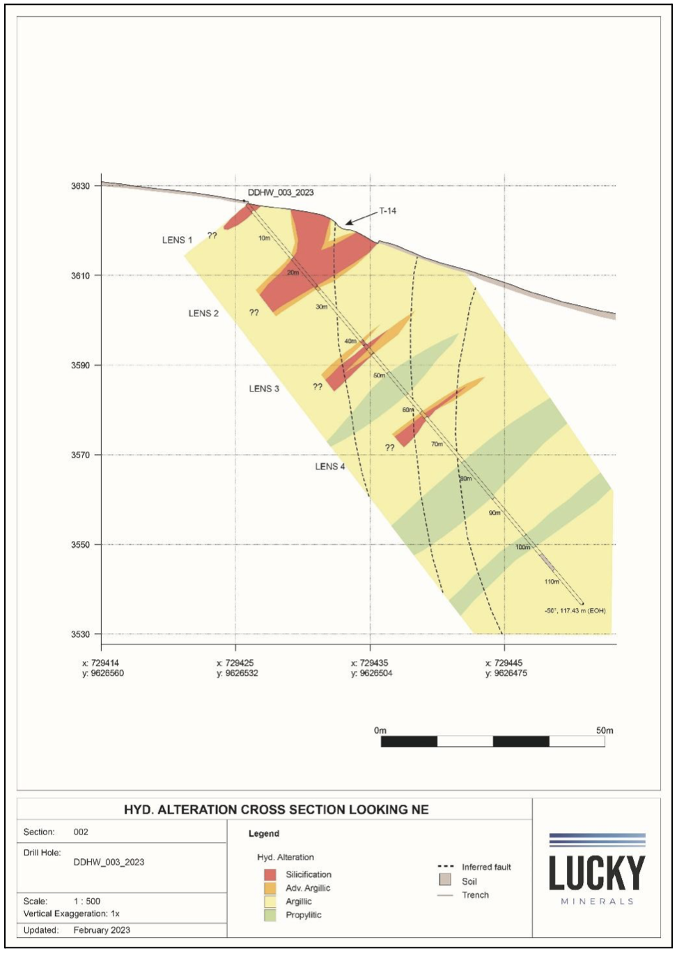
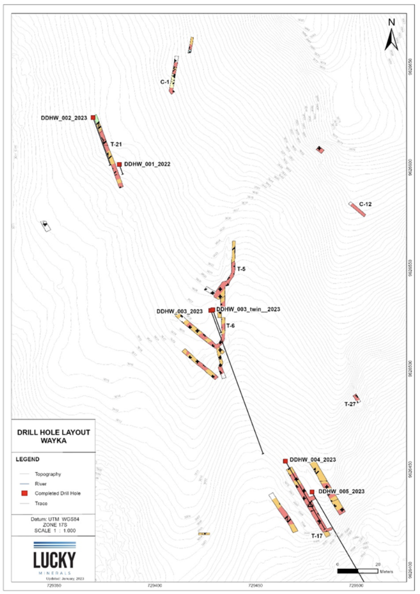
Ongoing Drill Progam
Lucky has commenced drilling at Wayka. Todate 384 metres of drilling have been completed over five shallow holes at the Discovery Zone. All five holes returned anomalous gold mineralization, results include:
10 metres at an average grade of 0.68 g/t gold (DDHW-003-2023)
7 metres at an average grade of 0.64 g/t gold (DDHW-001-2023)
5.82 metres at an average grade of 0.87g/t gold (DDHW-005-2023)
Lucky’s Team believe that these initial drill holes have intersected the margins of the epithermal gold system and that additional drilling will allow us to vector into the higher-grade feeder structures within the system. Lucky plans to intensify work as it continues to drill test the newest gold discovery in Ecuador.


Ongoing Trenching Program
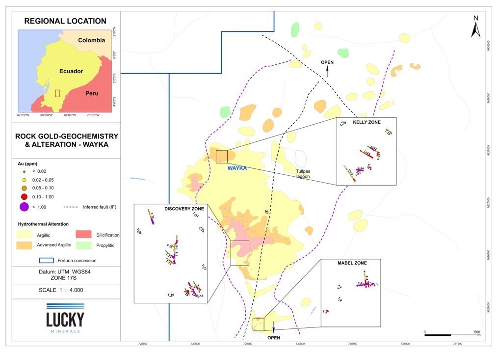
Lucky is completing an ongoing trenching and channel sampling program that has to date defined three zones of epithermal gold mineralization at surface over an intermittent 3.0 km long expression, results include:
Discovery Zone:
61 meters at a grade of 1.67 g/t gold (T-5 & T-6 combined), including 3 meters at a grade of 17.63 g/t gold (T-6)
9 meters at a grade of 8.02 g/t gold (T-14)
14 meters at a grade of 5.24 g/t gold, including 5 meters at a grade of 10.75g/t gold (T-21)
36 meters at a grade of 0.86 g/t gold (T-17)
2 meters at a grade of 2.81 g/t gold (T-10)
2 meters at a grade of 1.21 g/t gold (T-11)
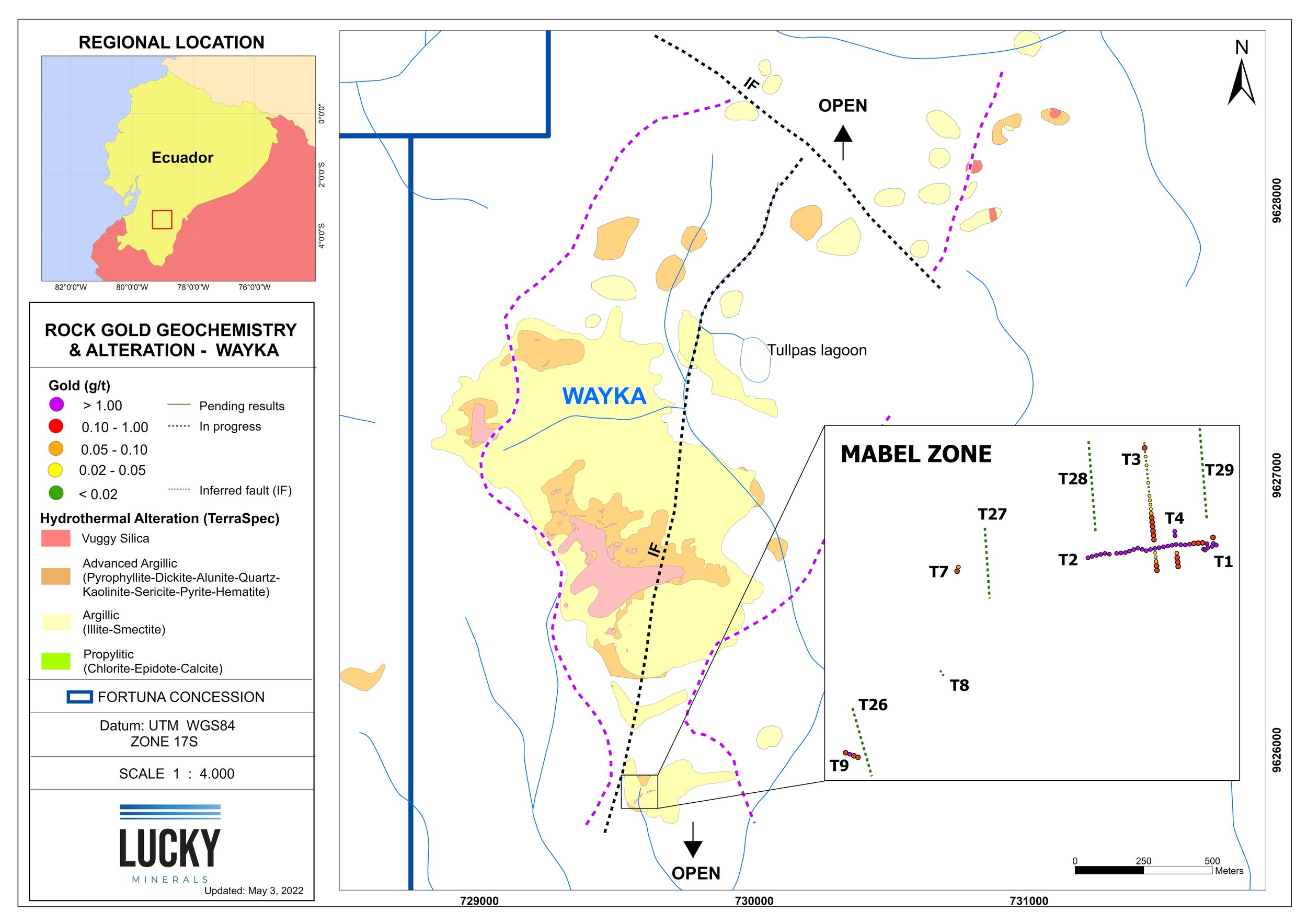
Mabel Zone
27 meters at a grade of 1.92 g/t gold (T-2)
4 meters at a grade of 3.06 g/t gold (T-1)
17 meters at a grade of 0.32 g/t gold, including 9 meters at a grade of 0.56 g/t gold (T-3)
7 meters at a grade of 0.79 g/t gold (T-4)
4 meters at a grade of 0.59 g/t gold (T-9)
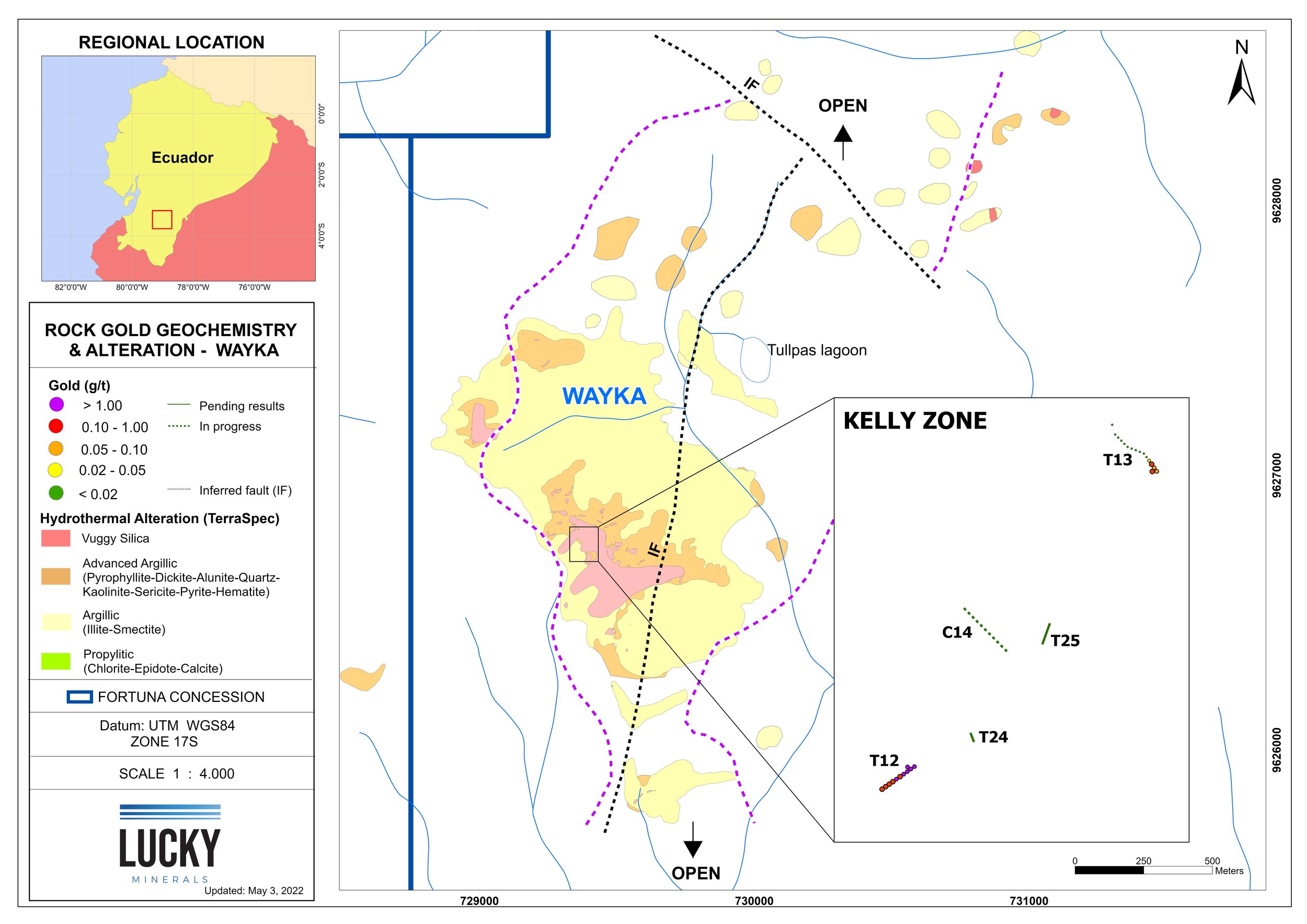
Kelly Zone
10 meters at a grade of 1.21 g/t gold (T-12)
13 meters at a grade of 1.04 g/t gold (C-20)
25 meters at a grade of 0.46 g/t gold, including 11 meters at a grade of 0.98g/t gold (C-21)
T-24 and T-25 are in silicified hydrothermal breccias and returned anomalous gold
Trench T-26 in silicified schists also returned anomalous gold
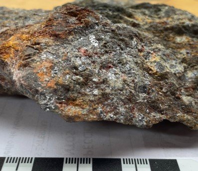
Magnetite Lens
In addition to the epithermal gold mineralization, our first prospecting campaign 1km ENE of the Wall Zone defined a massive lens of magnetite with pyrite veinlets and disseminations hosted in a leucocratic coarse-grained granite. The magnetite lens strikes northwest and has a vertical dip. A sample taken across one metre returned:
1 meter at a grade of 7.81 g/t gold
The lens lies approximately 1.2 km east of the El Buitre porphyry prospect.

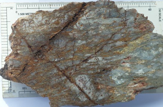
Geology
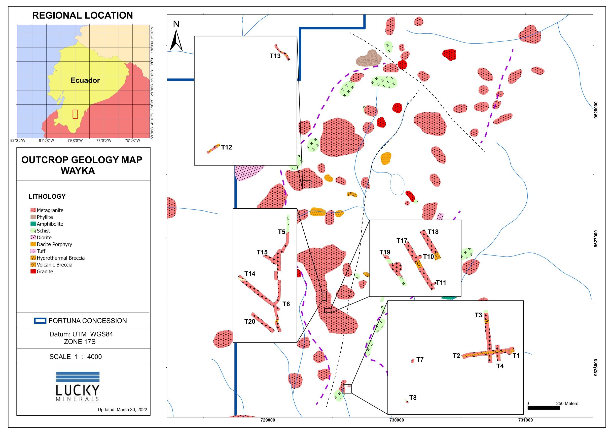
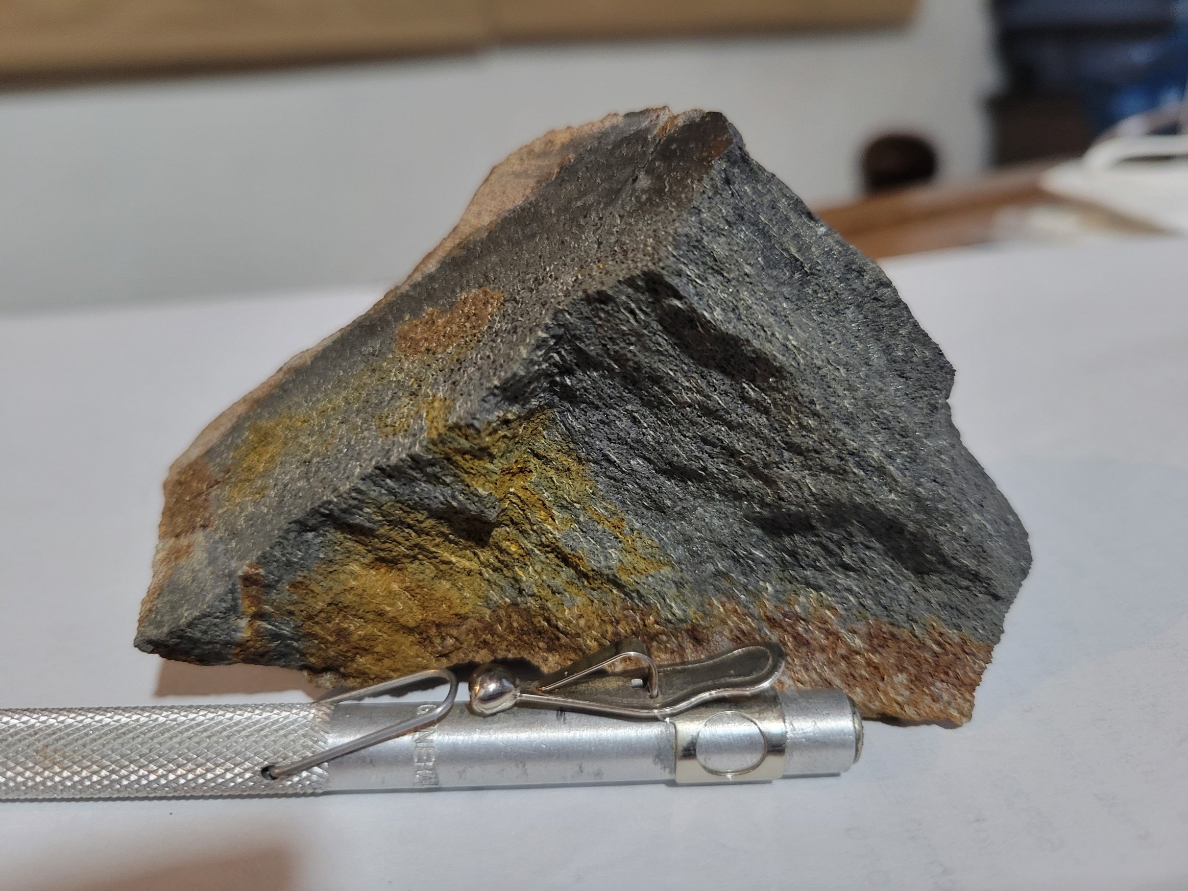
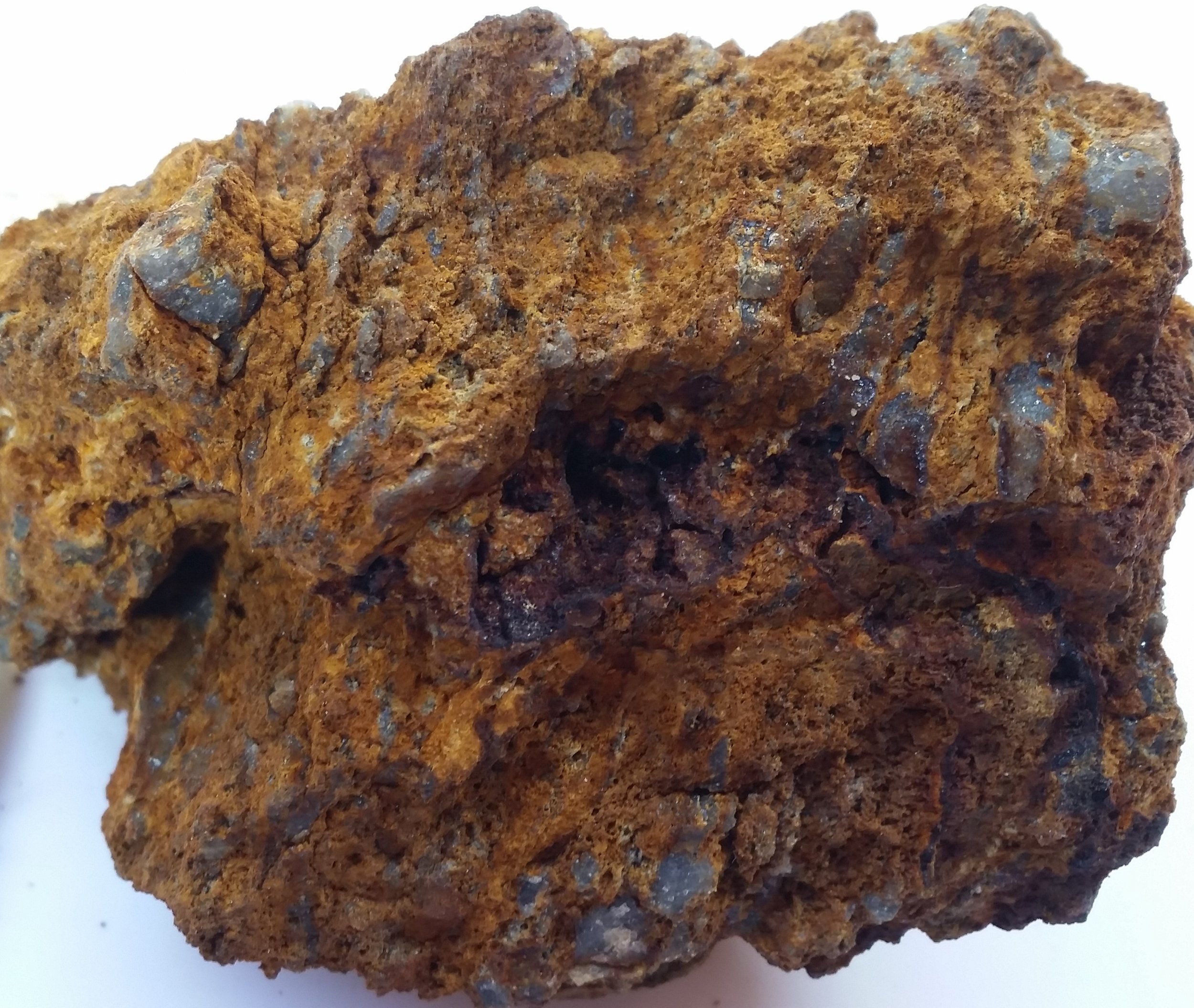
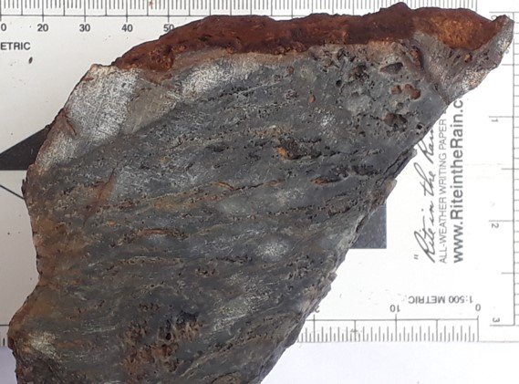
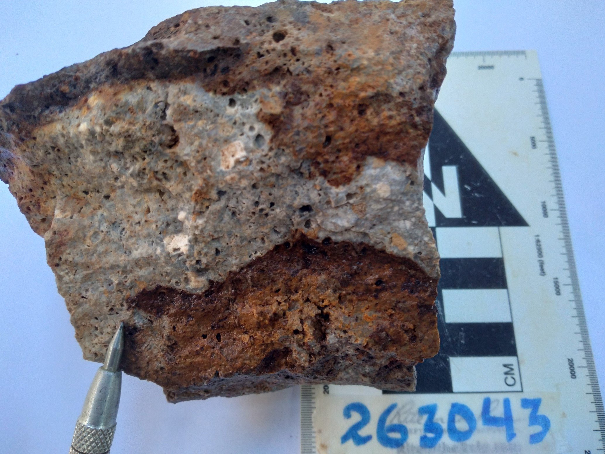
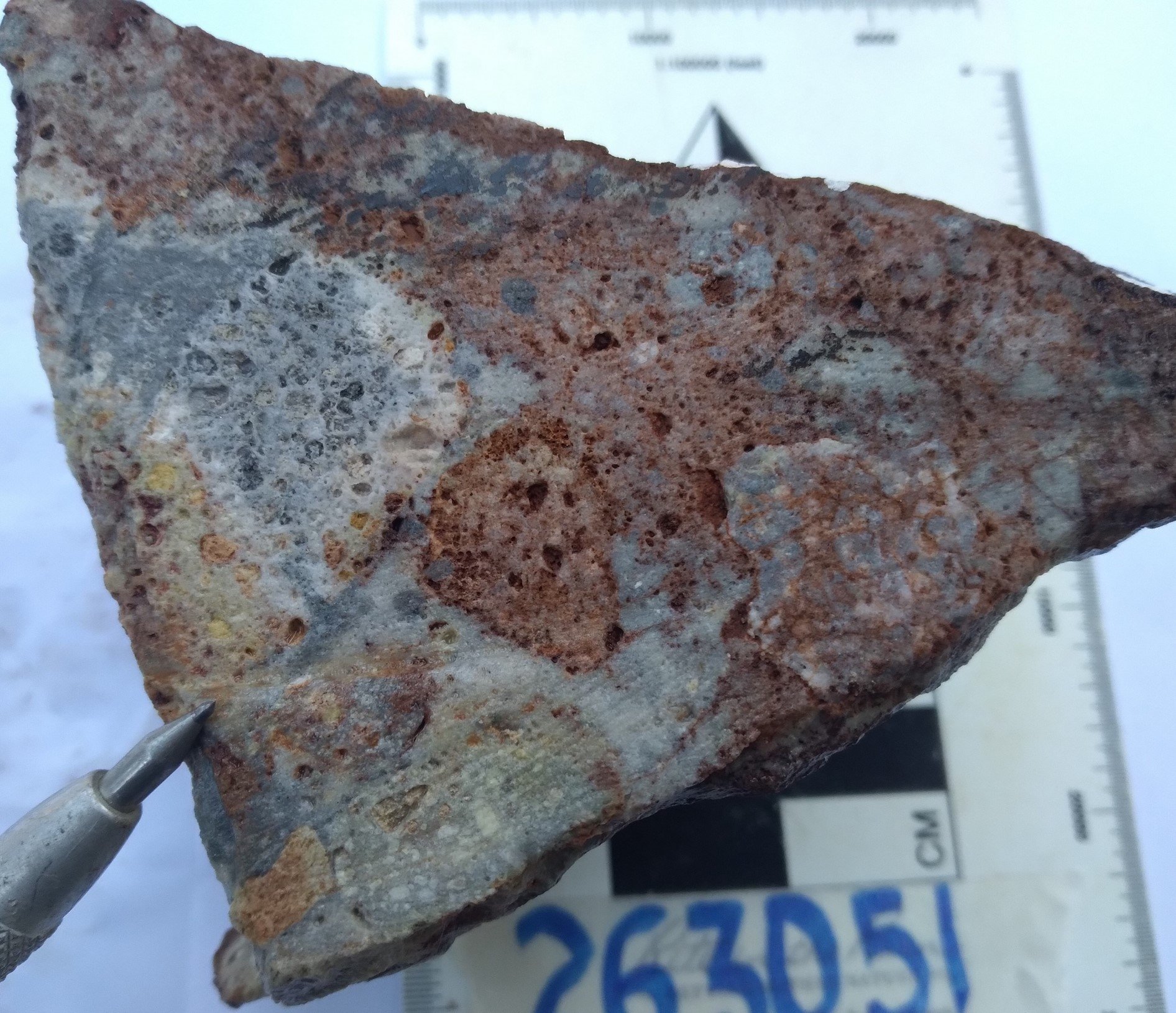
At Wayka the dominant rock types are schists, meta-granites, rhyolites and breccia zones. Gold values have been observed not only within rhyolites, but also in the contact zones and within meta-granites and schistose rocks. Gold mineralization appears to be influenced by the intersection of NW, NE and EW trending faults and fractures.
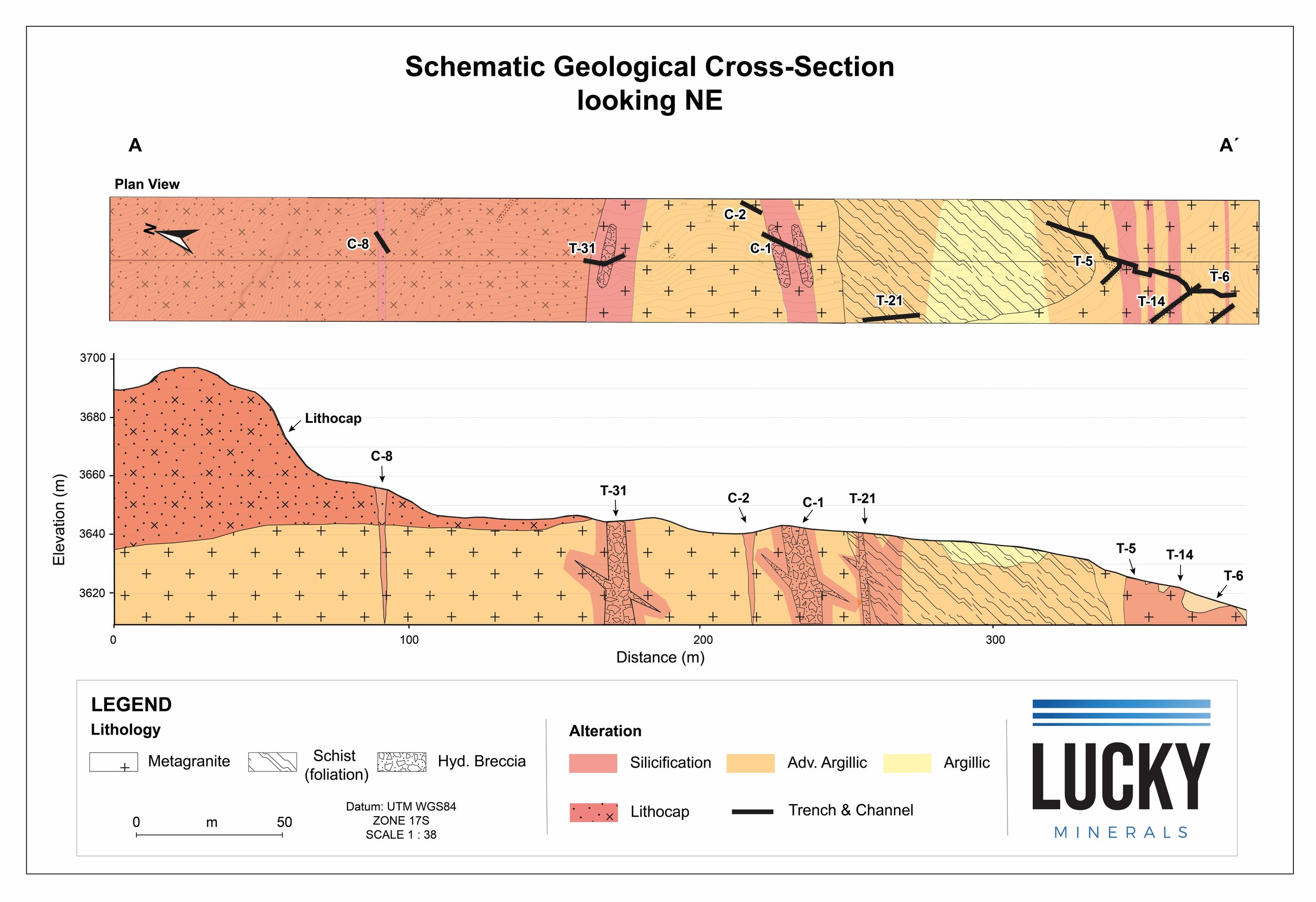
At the northern end of the Discovery Zone, recent interpretation has suggested the presence of a remnant silica cap that may overlie gold mineralization in this area. Mineralization exposed by erosion in Trench 14 returned 8.02 g/t gold across 9 metres (News Release November 18, 2021) and Trench 21 returned 5.24 g/t gold across 14 metres (News Release April 13, 2022). Both these trenches lie below the interpreted silica cap in the central part of the Discovery Zone, whereas Channel 8 and Trench 31 lie within and at the base of the silica cap and returned mainly anomalous gold values. The current interpreted lithocap appears to be present at an elevation from approximately 3,697 m to 3,643 m while the higher-grade trenches (trenches 14 and 21) are located at a lower elevation of approximately 3624 m.
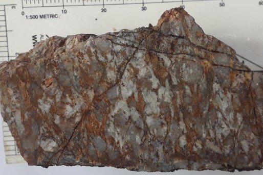
Lithocaps associated with high-sulphidation epithermal systems typically occur as silicic altered rocks with pyrite, either as stratabound replacements, veins and/or breccia cement. Silica caps are erosional remnants of what were once extensive lithocaps and may be considered the upper sections of epithermal systems. Silica caps are mostly barren and/or weakly anomalous of significant gold mineralization but offer significant perspectivity at depth.
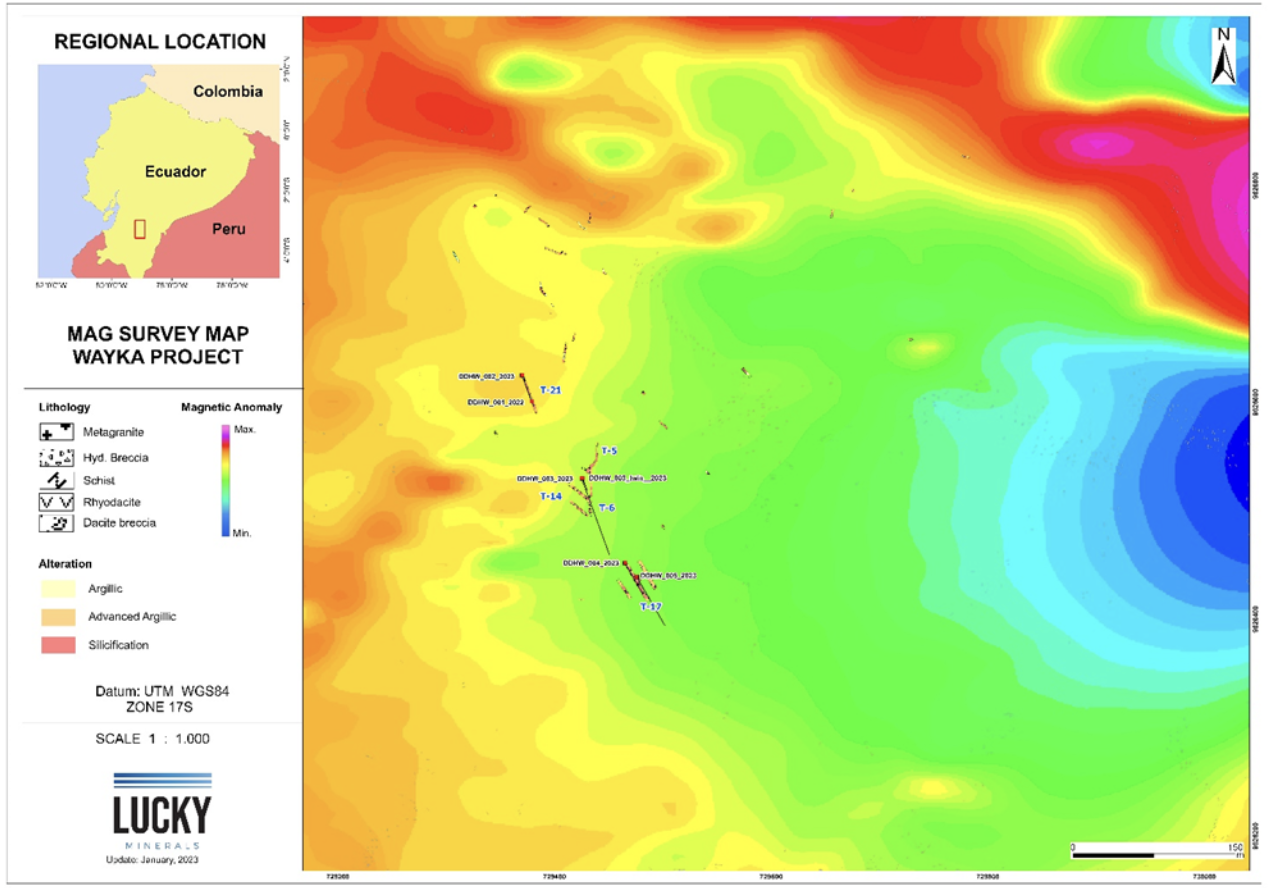
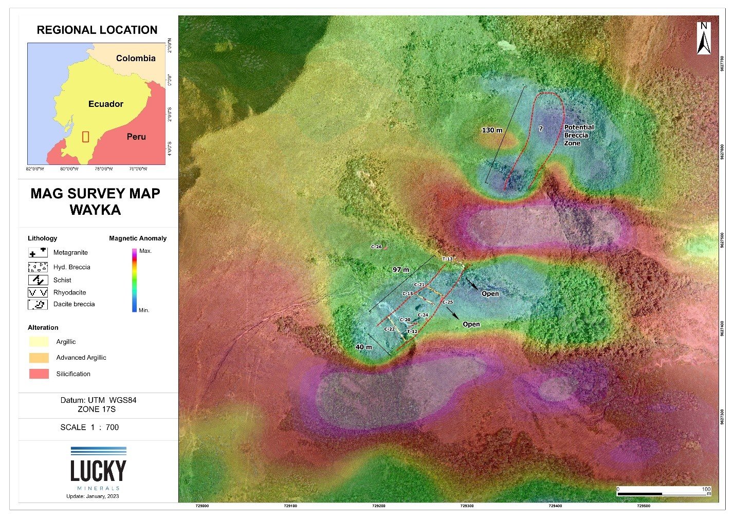
In the Kelly Zone, located 950 metres north of trench T-5 in the Discovery Zone, recent trenching and channel sampling has defined a silicified hydrothermal breccia that extends over a strike length of 100 meters with a width of 40 meters. The breccia contains significant gold mineralization in several areas and also coincides with a magnetic low. This breccia zone consists of sub-rounded to sub-angular fragments of dacite, meta-granite and schist.
The low-magnetic anomalies are believed to result from the passage of hydrothermal fluids through rocks, destroying the existing magnetite and creating a low-magnetic signature relative to the surrounding rocks. The hydrothermal fluids create the alteration zones of silicification and advanced argillic alteration identified in the Kelly breccia zone.
As geological field work at Wayka continues, we anticipate our understanding of the mineralized system to improve as more detailed work is completed. At present, Wayka has been observed to remain open in all directions.
AlTertation
At Wayka we are yet to fully define the scale of the alteration halo but early indications are that it is comparable to that of a number of globally significant high-sulfidation epithermal gold deposits.

After Hedenquist, 2002, All images apart from Wayka are projections to surface. Wayka shows the interpreted outline of the alteration system based on the surface mapping and Terraspec analysis completed to date.
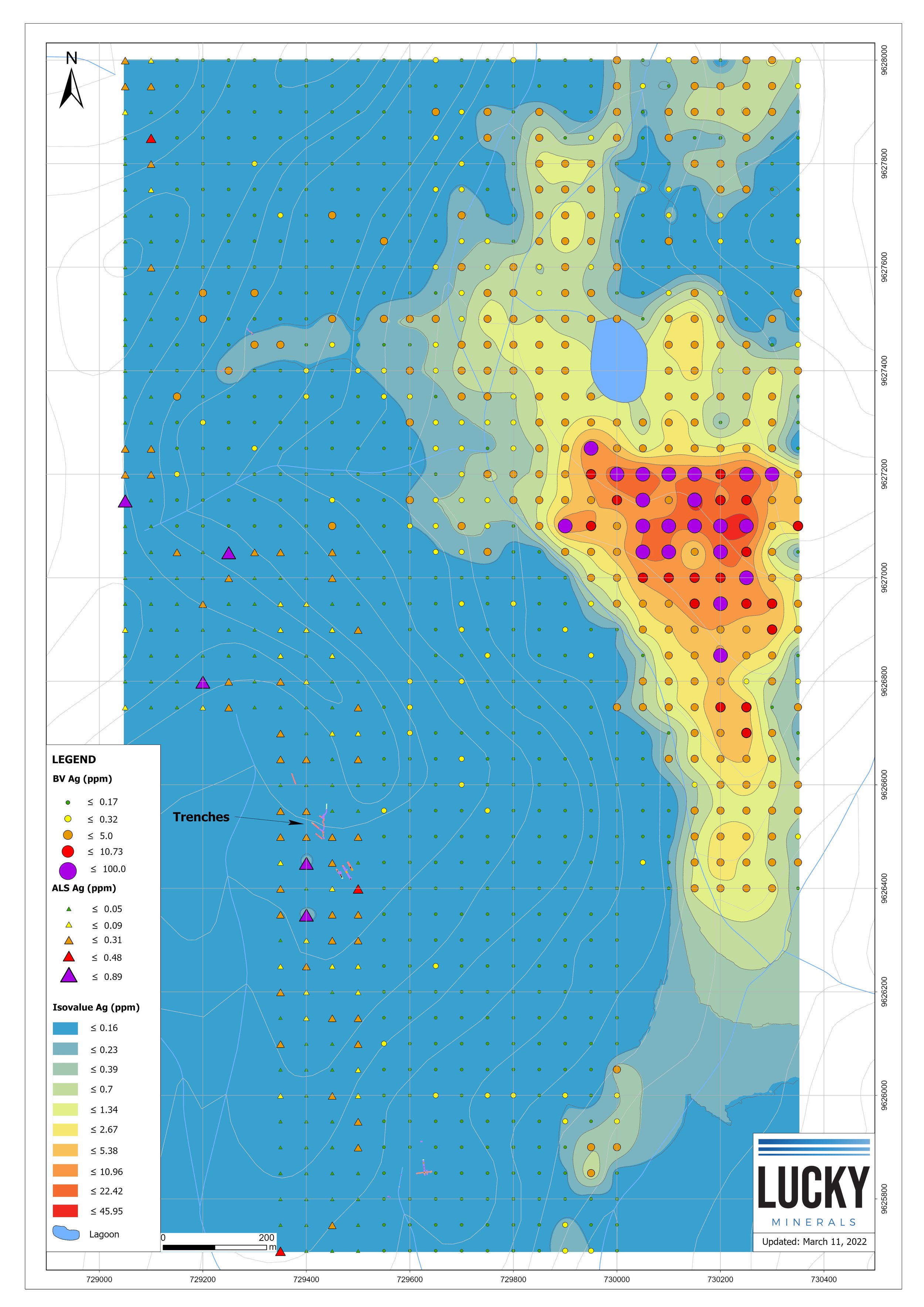
anomalies
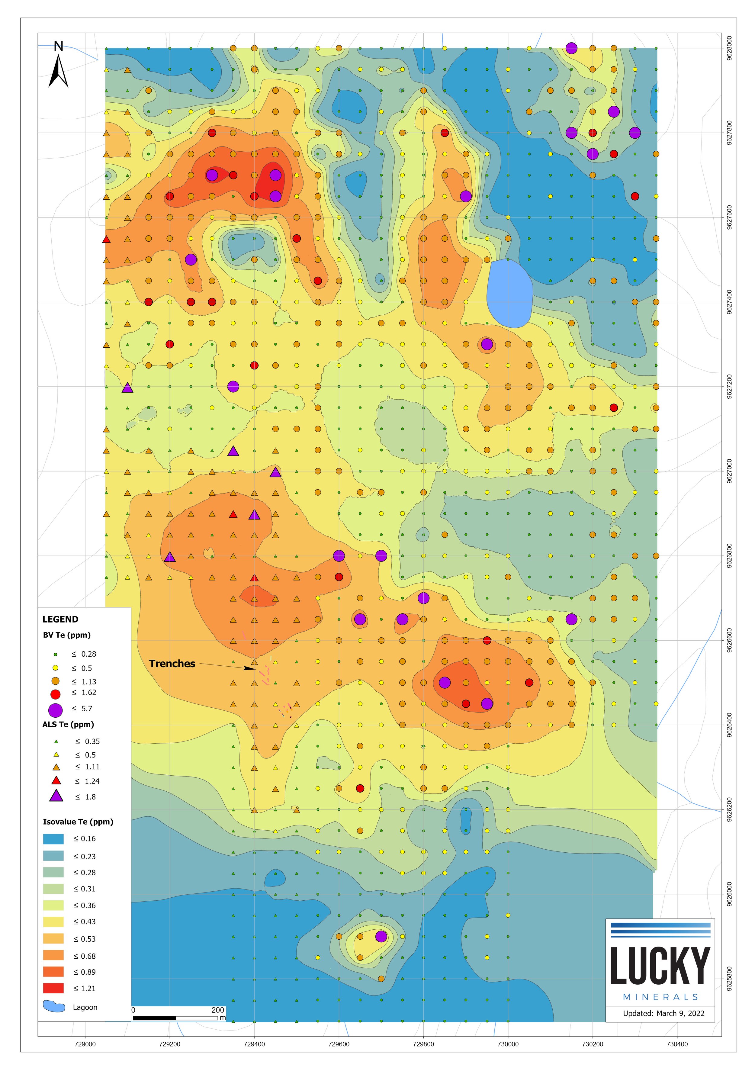
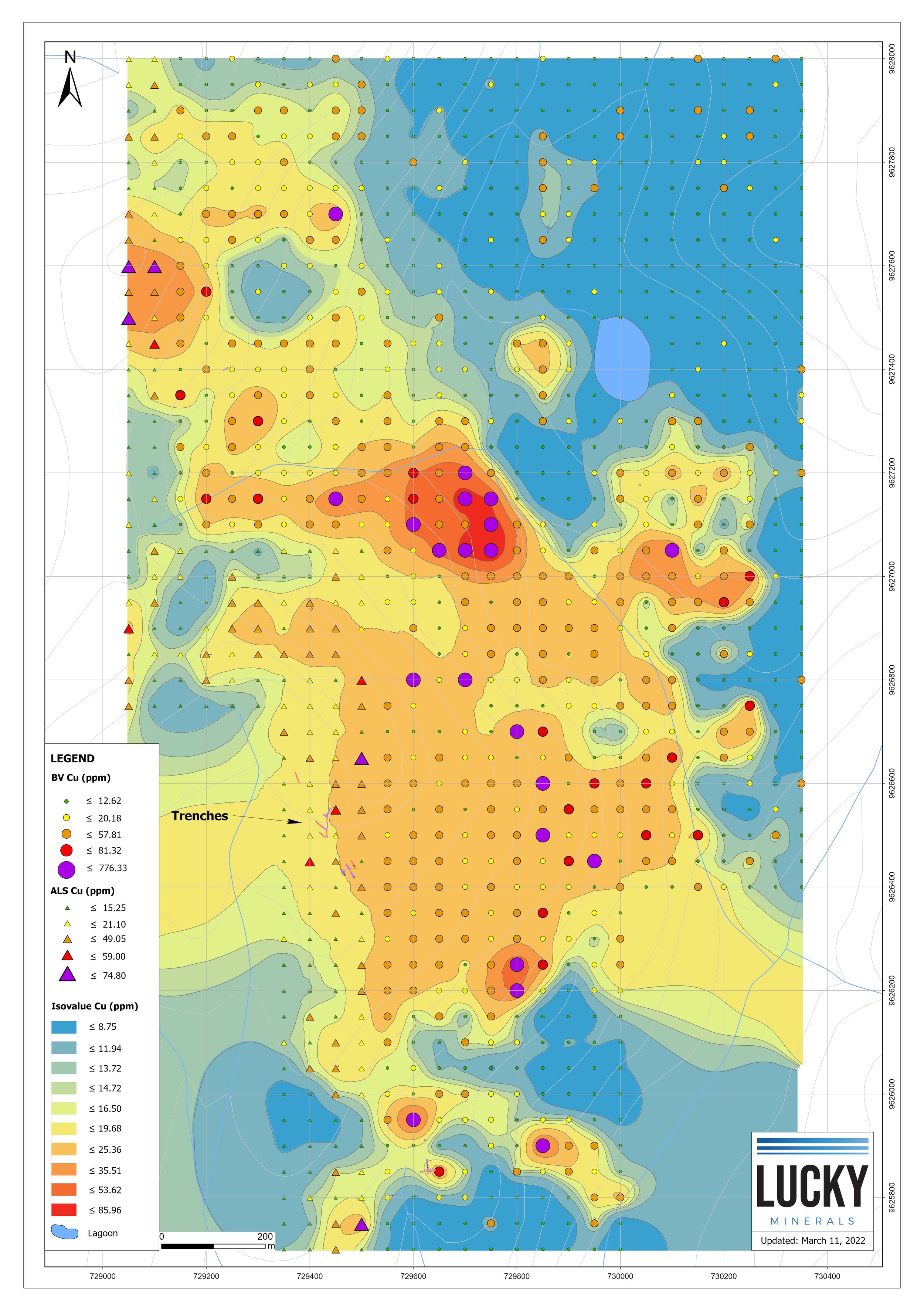
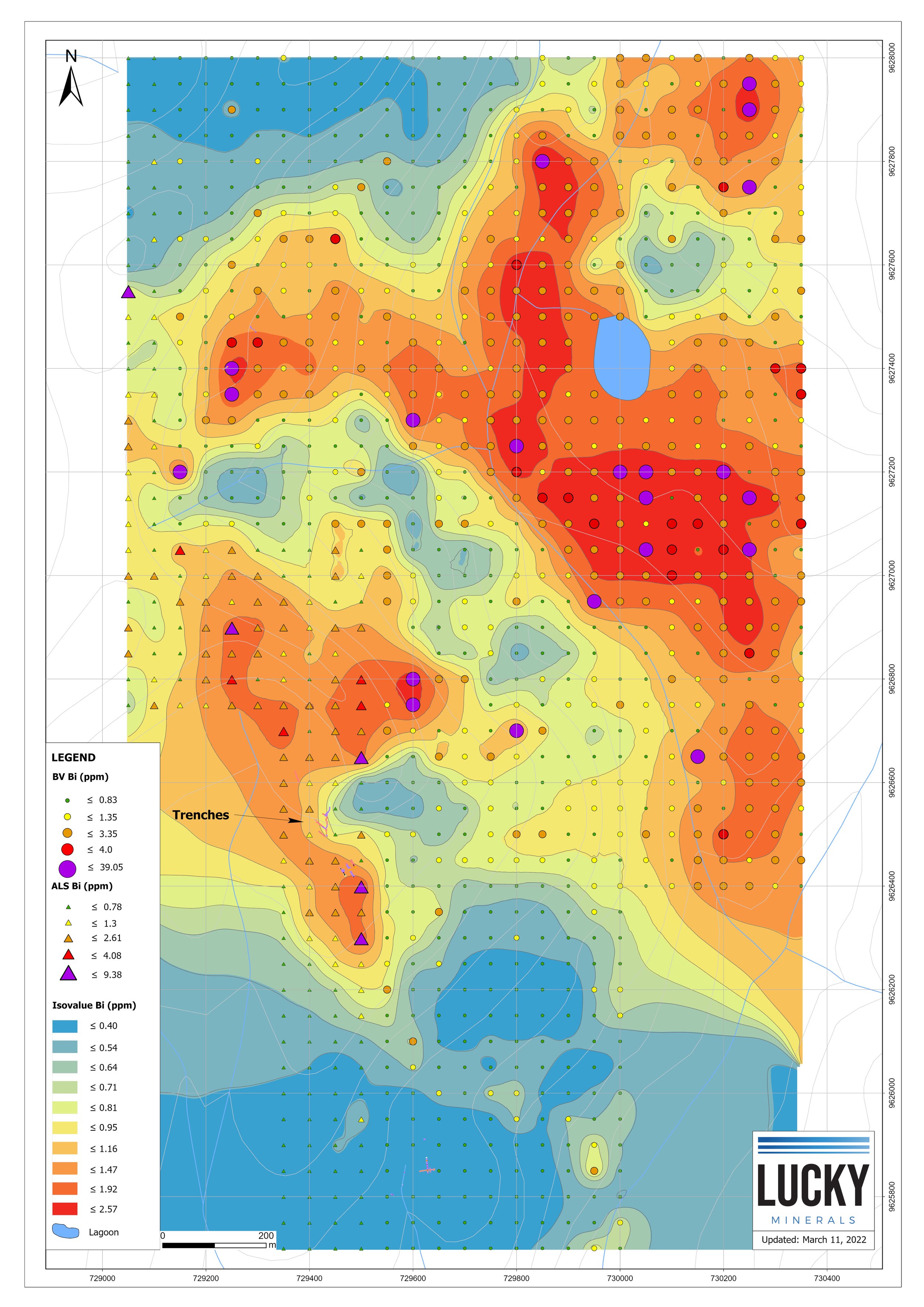
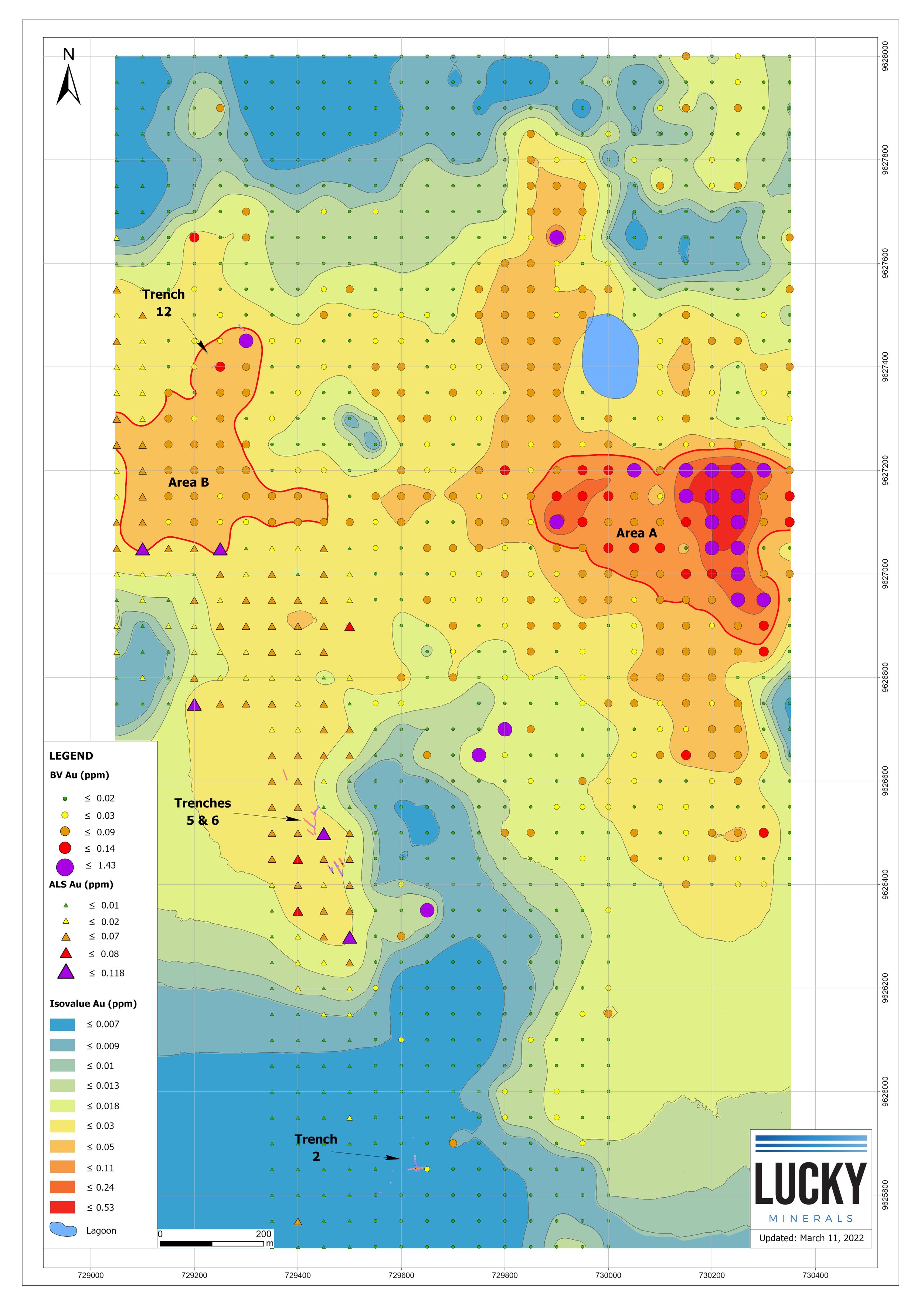
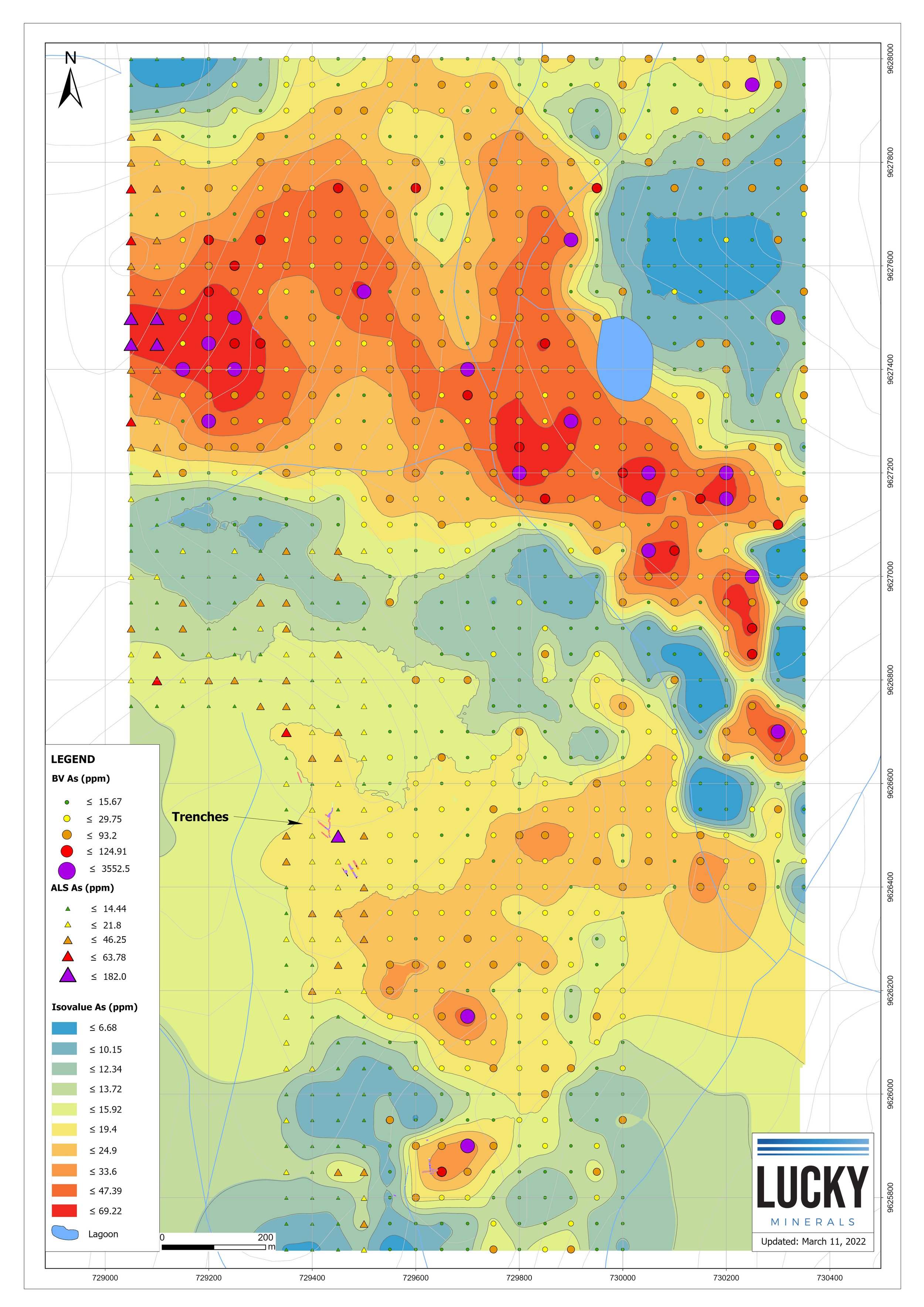
In Q1 2022 Lucky completed a program of soil sampling across a 50 x 50 meter grid at Wayka. The total grid area covered approximately 2.44 km2 and defined two large anomalous gold areas in the northern section of Wayka. Approximately 37% of the samples were found to contain anomalous gold grades and the two anomalies cover a total area of approximately 1.19 km2.
Anomalous area “A” (strongest anomalous gold area) measures approximately 700 x 400 meters and lies approximately 950 meters NE of trenches 5,6 and 14. Soil gold values in this area range from 0.035 up to 1.43 ppm gold.
Anomalous area “B” measures approximately 425 x 300 meters and lies approximately 540 meters NNW of trenches 5,6 and 14. Soil gold values in this area range from 0.031 up to 0.19 ppm gold. Please see map below.
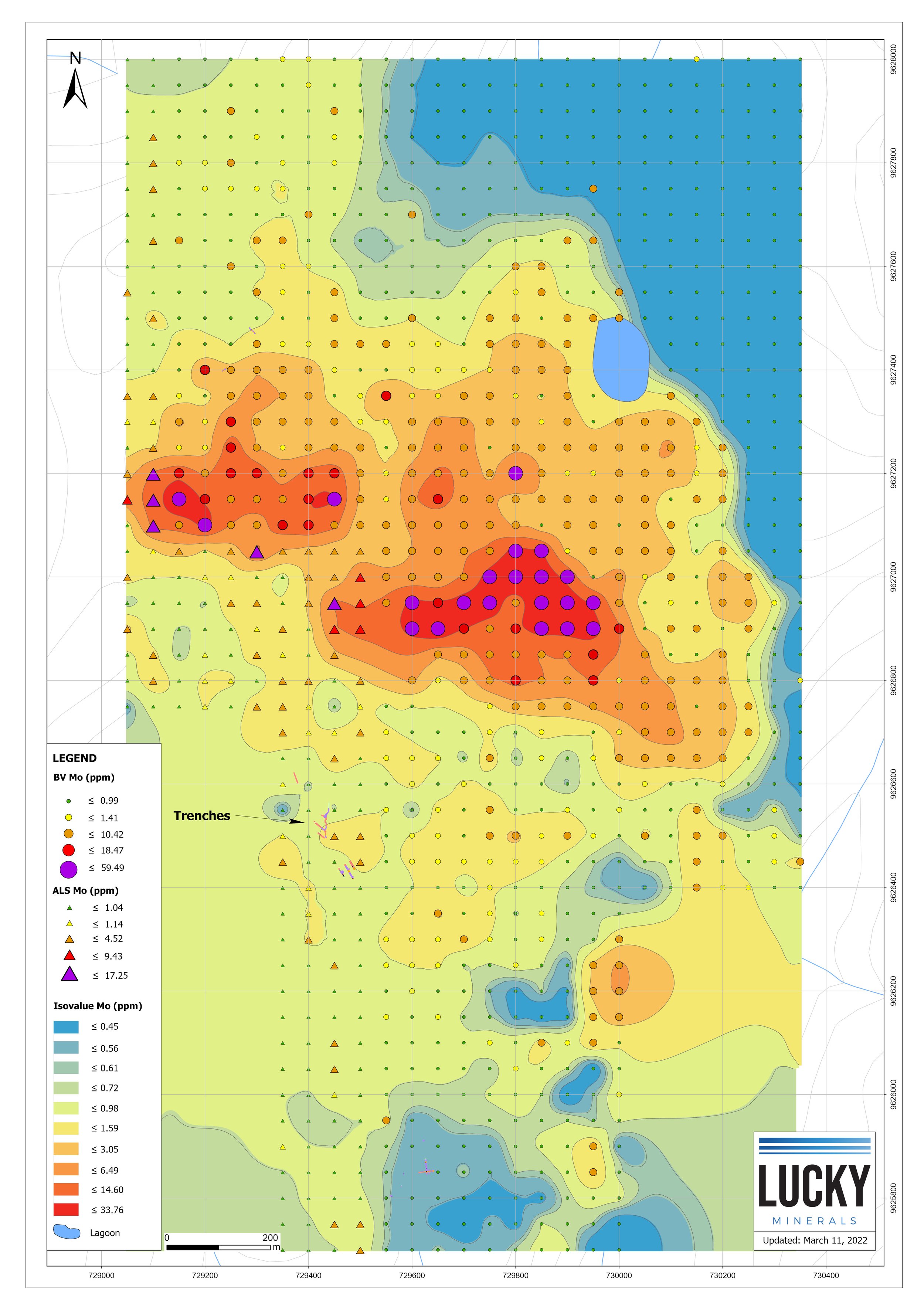
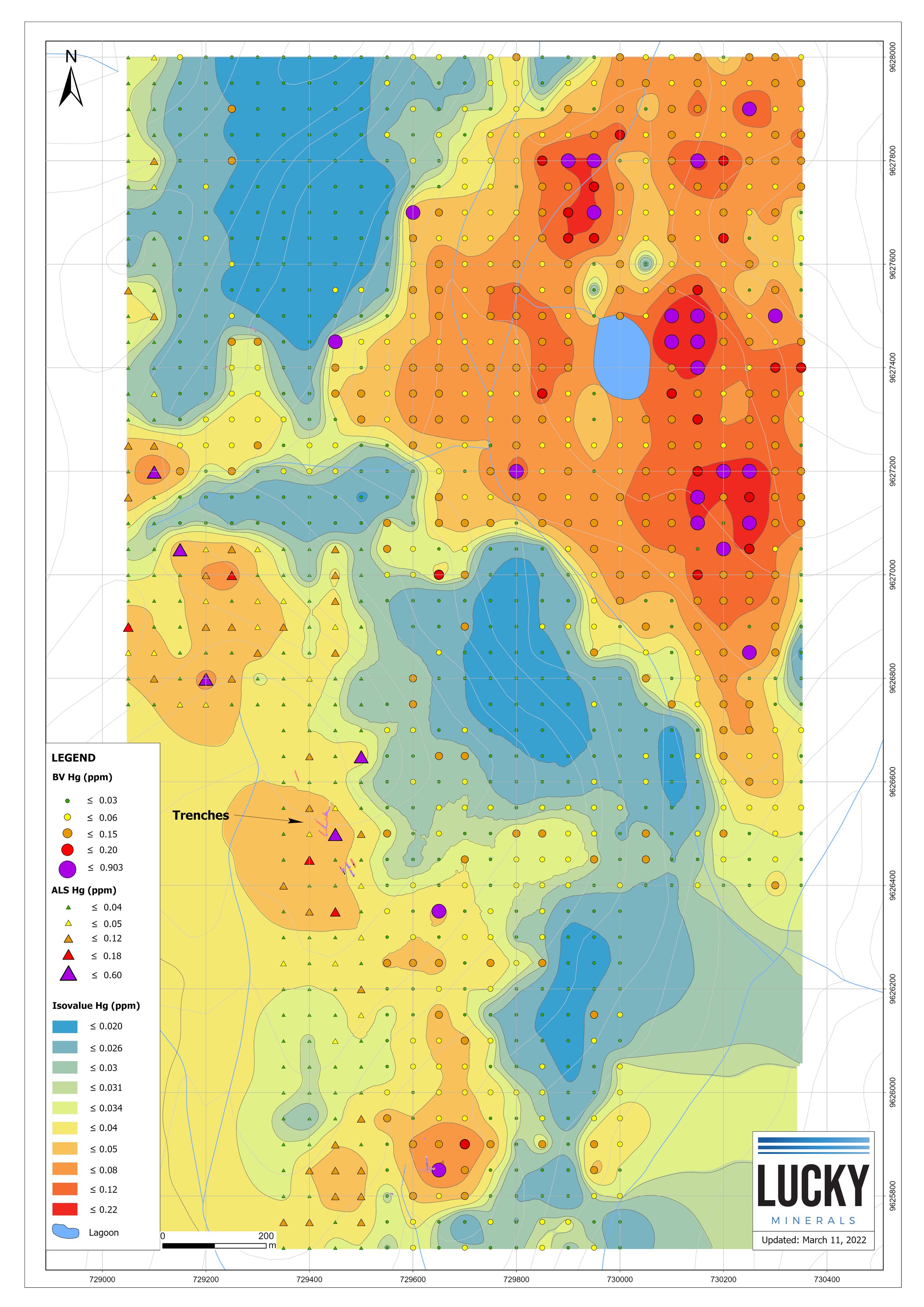
In addition to the gold anomalies, large anomalies of silver and gold tracer, or pathfinder, minerals such as arsenic, bismuth, tellurium and antimony, amongst other metals, were also found. Please see images below.

Rock Types


Next Steps
Current field work is focused on the Discovery and Kelly Zones. There are another 236 assays pending from ongoing field work.
Latest news release
Macuche
The Macuche Target is located within the southern portion of the Fortuna concessions.
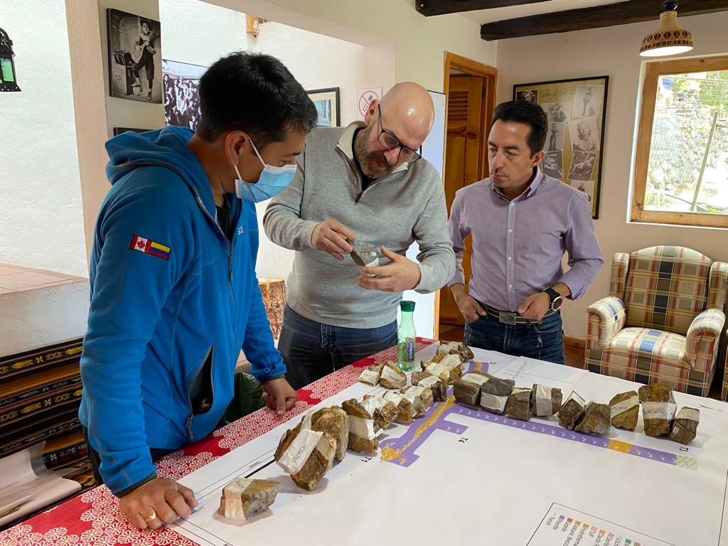
Lucky’s exploration team has been conducting a program of geological mapping and sampling at the target. This work has defined the presence of gold mineralization within quartz-pyrite (hematite) stockwork type veinlets in a strongly altered (sericitic) schist.
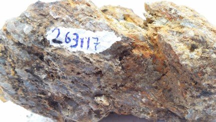
Grab sampling has returned:
2.19 g/t gold (#261598)
1.98 g/t gold (#262652)
1.66 g/t gold (#261057)
A 20-meter-long trench returned an average of 0.33 g/t gold, demonstrating the presence of a pervasive stockwork system and the potential for bulk tonnage gold target. The mineralization in the trench remains open both to the east and to the west. More work needs to be done in the area to understand both the scale and controls of the mineralisation.

Next Steps
Field work continues at Macuche mainly comprised of geological mapping and sampling. Also, old pit excavations are being cleared of brush to expose the bedrock.
latest news release
El Garo
The El Garo gold target is located, less than 8 km north of the Wayka Discovery, in the northern portion of the Fortuna concessions.
El Garo is characterized by a large area of advanced argillic alteration measuring approximately 2 km by 1 km and is open in all directions.
Geology
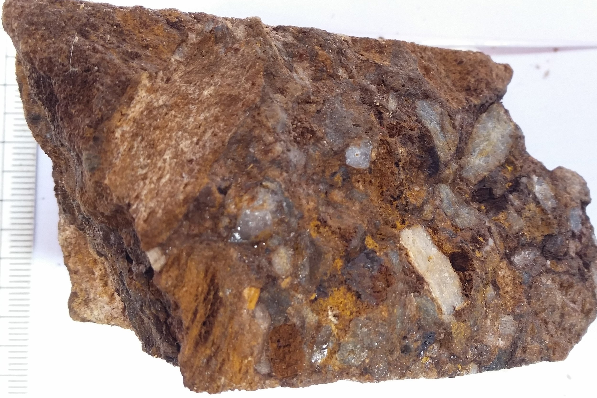
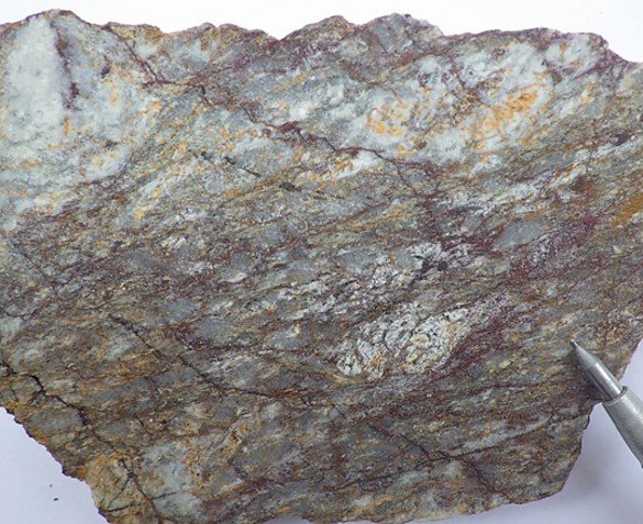
The host rocks are dacite tuffs with outcrops of vuggy silica, hydrothermal breccias, alunite, and jarosite. These rock types and alteration minerals are typical of high sulphidation precious metal systems.
El Garo is a large epithermal system with outcrops of dacite and vuggy silica
Next Steps
Lucky has completed an extensive soil program for a total of 868 soil samples covering an area of approximately 4.4 km by 2 km. These results will be combined with a detailed magnetic survey, culminating in a maiden drill program at El Garo.

Latest news release
ECUADOR - A Country Of Opportunity
growth
Recently, 28 internationally renowned mining companies, including BHP Billiton, FMG, Anglo, Newcrest and Codelco, have established entities in Ecuador and spending billions in the country on exploration.
no new players
Moratorium on staking requires new mining companies to partner with current concession owners, such as Lucky.
among friends
Bordered by well-established mining destinations, Ecuador is the geological continuity of Chile & Peru and represents under-explored potential for discovery of new world class copper and gold deposits.
friendly jurisdiction
Positive geopolitical environment and new tax regulatory reforms has lead to influx of major mining companies and enhanced investment in the country.


road access
Close access to the Pan American Highway and secondary roads for year round access.
Water
Abundant fresh water supplies available throughout the property.
power
Nearby high-voltage power lines provide easy access to power as the project progresses.

skilled workforce
A large, highly skilled mining workforce within the area makes local employment possible.

year-round opportunity
The local climate does not hamper access or ability to work on the Fortuna Project.